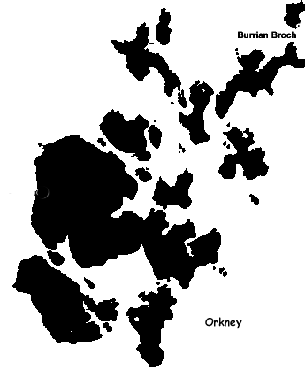
 Burrian Broch is located on the southern point of North Ronaldsay, Orkney's northern-most isle. It has experienced two phases of occupation and possibly a third. The broch is thought to date from the first or second centuries B.C.. although there is some evidence of earlier habitation.
On the approaches to the broch, there are lines of four defensive ditches, probably a number of dwellings. A geophysics survey in 2005 by Orkney College Geophysics Unit identified the remains of structures outside the ramparts.
As for the broch itself, the wall is 14+ feet (4.5 meters) thick, enclosing a courtyard of almost 33 feet (10 meters) in diameter. The entrance is in the southeast from the shore, and the walls are solid. There is a wall cell in the northeast arc. A peculiarity of the construction is a 4 foot (120 cm) high "intake" above a ledge 3 foot (90 cm) above the original occupation floor. There is a well in the interior courtyard. The broch is defended by the remains of four ramparts on the landward side.
In its second phase, the broch was converted into a sort of wheelhouse with internal divisions. Buttressing on the outer face of the northwwest arc and several small buildings on the north arc may also belong to this period.
Speculation of a third phase - a Christian monastery or hermitage - is provided by the discovery of an early cross with an Ogham inscription, an ox-bone with Pictish symbols, and a pebble with Celtic designs. A Celtic bell of the earlier type (5th-9th centuries A.D.) was also found. The most significant find was a stone slab 2-1/4 (686 mm) long, engraved with a cross and Ogham script and named the Burrian Cross, which has become one of the symbols of Orkney. It and the above mentioned finds are now displayed in the National Museum of Antiquities of Scotland.
About the Burrian Broch Burrian Broch is located on the southern point of North Ronaldsay, Orkney's northern-most isle. It has experienced two phases of occupation and possibly a third. The broch is thought to date from the first or second centuries B.C.. although there is some evidence of earlier habitation.
On the approaches to the broch, there are lines of four defensive ditches, probably a number of dwellings. A geophysics survey in 2005 by Orkney College Geophysics Unit identified the remains of structures outside the ramparts.
As for the broch itself, the wall is 14+ feet (4.5 meters) thick, enclosing a courtyard of almost 33 feet (10 meters) in diameter. The entrance is in the southeast from the shore, and the walls are solid. There is a wall cell in the northeast arc. A peculiarity of the construction is a 4 foot (120 cm) high "intake" above a ledge 3 foot (90 cm) above the original occupation floor. There is a well in the interior courtyard. The broch is defended by the remains of four ramparts on the landward side.
In its second phase, the broch was converted into a sort of wheelhouse with internal divisions. Buttressing on the outer face of the northwwest arc and several small buildings on the north arc may also belong to this period.
Speculation of a third phase - a Christian monastery or hermitage - is provided by the discovery of an early cross with an Ogham inscription, an ox-bone with Pictish symbols, and a pebble with Celtic designs. A Celtic bell of the earlier type (5th-9th centuries A.D.) was also found. The most significant find was a stone slab 2-1/4 (686 mm) long, engraved with a cross and Ogham script and named the Burrian Cross, which has become one of the symbols of Orkney. It and the above mentioned finds are now displayed in the National Museum of Antiquities of Scotland.
About the Burrian Broch
Howar: Burrian Broch
Megalithic Portal: Burrian Broch
Modern Antiquarian: Burrian Broch
Wikipedia: Broch of Burrian
Journey to the Burrian Broch
The broch is located on the southern tip of North Ronaldsay, a walk of about 1/2 hour from the ferry.
Streetmap UK NGR HY76275138.
Visitors Information
Visitors information for the Burrian Broch may be found at the Hower website. General tourist information for North Ronaldsay may be found on the Orkney.com website.
Additional Photos of the Burrian Broch
Logan Air Plane to North Ronaldsay
Inside the Logan Air Plane to North Ronaldsay
The Airport on North Ronaldsay
The Beach Start of the Walk to Burrian Broch
First Look at Burrian Broch in the Distance
Approaching Burrian Broch
The Entrance to Burrian Broch
Looking Back at the Opening to Burrian Broch
The Interior of Burrian Broch Showing the Well
Close-Up of the Well Inside Burrian Broch
Interior Wall of Burrian Broch
Inside Burrian Broch
Entrance to the Ledge Area of Burrian Broch
The Ledge Area of Burrian Broch
Side of the Outside of Burrian Broch
Exterior Walls of Burrian Broch
Back Walls of Burrian Broch
Area of Settlements Near Burrian Broch
Settlement Area Outside Near Burrian Broch
Settlement Area Outside Near Burrian Broch
Settlement Area Outside Near Burrian Broch
Leaving Burrian Broch
|