 Clachtoll Broch was home to a farming family in the Iron Age until it was destroyed by a huge fire. The broch sits high up on a prominent rocky coastal outcrop, flanked by sharp crags on the seaward side and a steep slope on the landward side. The doorway into the broch is topped by a huge triangular stone. Passing under this, visitors to the broch enter a roughly paved passage. which leads through the massive thickness of the wall into the interior.
The entrance passage to the broch is flanked by two small rooms, a by-product of the hollow walled design that allows them to attain their height. The cells themselves were probably mainly used for storage. At the heart of the broch was a massive hearth. The earliest hearth was formed of a massive sandstone flag laid on top of the lowest layer of flooring. To the right hand side of the entrance passage is a cell carpeted with natural grasses, reeds, and rushes. Over this was a layer of flagstones. On the left hand side of the passage, there is another cell that appears to have been used as a midden or dump. In addition, the broch contains an interior passageway that leads up to the outside of the broch and overlooks the coast.
Some 2000 years later, the community group Historic Assynt led a project to excavate the ruinous broch and rehabilitate it. The project revealed a snapshot of prehistoric life, perfectly preserved beneath the rubble.
About the Clachtoll Broch Clachtoll Broch was home to a farming family in the Iron Age until it was destroyed by a huge fire. The broch sits high up on a prominent rocky coastal outcrop, flanked by sharp crags on the seaward side and a steep slope on the landward side. The doorway into the broch is topped by a huge triangular stone. Passing under this, visitors to the broch enter a roughly paved passage. which leads through the massive thickness of the wall into the interior.
The entrance passage to the broch is flanked by two small rooms, a by-product of the hollow walled design that allows them to attain their height. The cells themselves were probably mainly used for storage. At the heart of the broch was a massive hearth. The earliest hearth was formed of a massive sandstone flag laid on top of the lowest layer of flooring. To the right hand side of the entrance passage is a cell carpeted with natural grasses, reeds, and rushes. Over this was a layer of flagstones. On the left hand side of the passage, there is another cell that appears to have been used as a midden or dump. In addition, the broch contains an interior passageway that leads up to the outside of the broch and overlooks the coast.
Some 2000 years later, the community group Historic Assynt led a project to excavate the ruinous broch and rehabilitate it. The project revealed a snapshot of prehistoric life, perfectly preserved beneath the rubble.
About the Clachtoll Broch
Clachtoll Broch Website
Megalithic Portal: Clachtoll Broch
Modern Antiquarian: Clachtoll Broch
Canmore: Clachtoll Broch
Undiscovered Scotland: Clachtoll Broch (before restoration)
Journey to the Clachtoll Broch
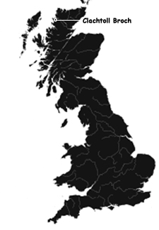
The broch is found between the small villages of Clachtoll and Stoer just off of the B869 in Assynt in the Highlands. There are two ways to visit the broch. Park at Clachtoll Beach car park, signposted from the B869. From here, you can follow the coastal path beyond the car park west and then north to the broch. Another route for walkers is south from Stoer beach towards the broch. Park at the cemetery on the right just passed the village of Clachtoll and cross the road and walk to the shoreline where you will find a path south to the broch.
Streetmap UK NGR NC03662784.
Visitors Information
Visitors information for the Clachtoll Broch may be found at the Clachtoll Broch website. General tourist information for the area may be found on the Discover Assynt website.
Additional Photos of the Clachtoll Broch
Approaching Clachtoll Village
Approaching Clachtoll Broch from the North
On the Seaside Path from the North to Clachtoll Broch
Approaching Clachtoll Broch
Entrance to Clachtoll Broch
Close-Up of the Lintel Over the Entrance to Clachtoll Broch
Inside the Entrance to Clachtoll Broch
Looking Back at the Exit from Inside Clachtoll Broch
Small Cell Used for Storage Inside Clachtoll Broch
Interior of Small Room Inside Clachtoll Broch
Quern Inside Clachtoll Broch
Interior Stairs Leading Up to Outside of Clachtoll Broch
Looking Out at the Coast from the Top of the Interior Stairs Inside Clachtoll Broch
The Back of Clachtoll Broch
|